GroundPin
“Pin it before you bury it.”
The crowdsourced ground-truth layer for UK groundworks. Workers drop GPS-accurate, photo-backed pins on a shared map so the next crew through doesn’t strike a buried cable, pipe, or main.
Four million kilometres of buried infrastructure. No single source of truth.
Utility strikes happen because the map the crew has on site doesn’t match what’s actually underground. GroundPin closes the gap — not by replacing LSBUD, NUAR, or CAT scanning, but by capturing what every crew learns the moment they learn it.
Geospatial Commission, 2024
UKSA
HSE
Built for muddy gloves and patchy signal
The mobile app is where work happens — drop a pin, add photos, classify the utility, log the depth, and it’s shared with your whole team in seconds.
Built for the job site, not the boardroom
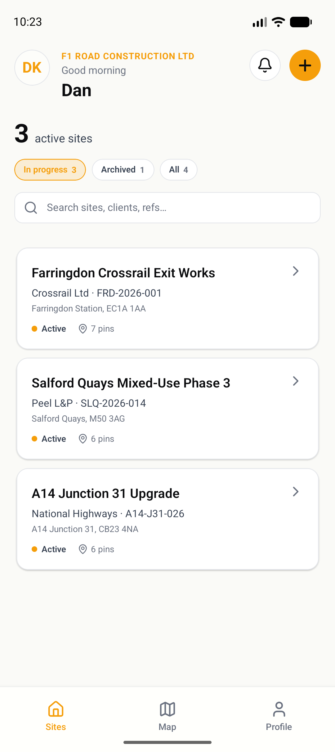
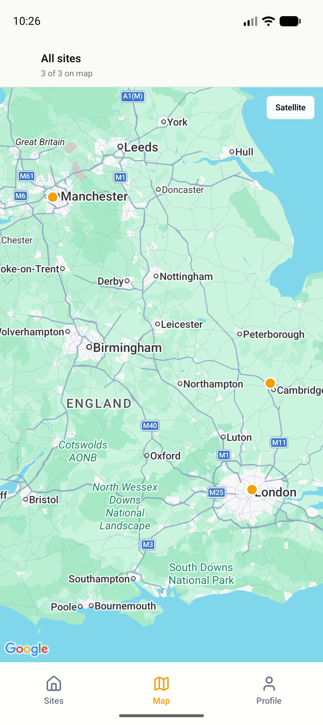
Sites & organisations
Group pins by site with address, reference codes, and client attribution. Multiple sites per organisation, active and archived. Subcontractors join individual sites without seeing the rest of your work.
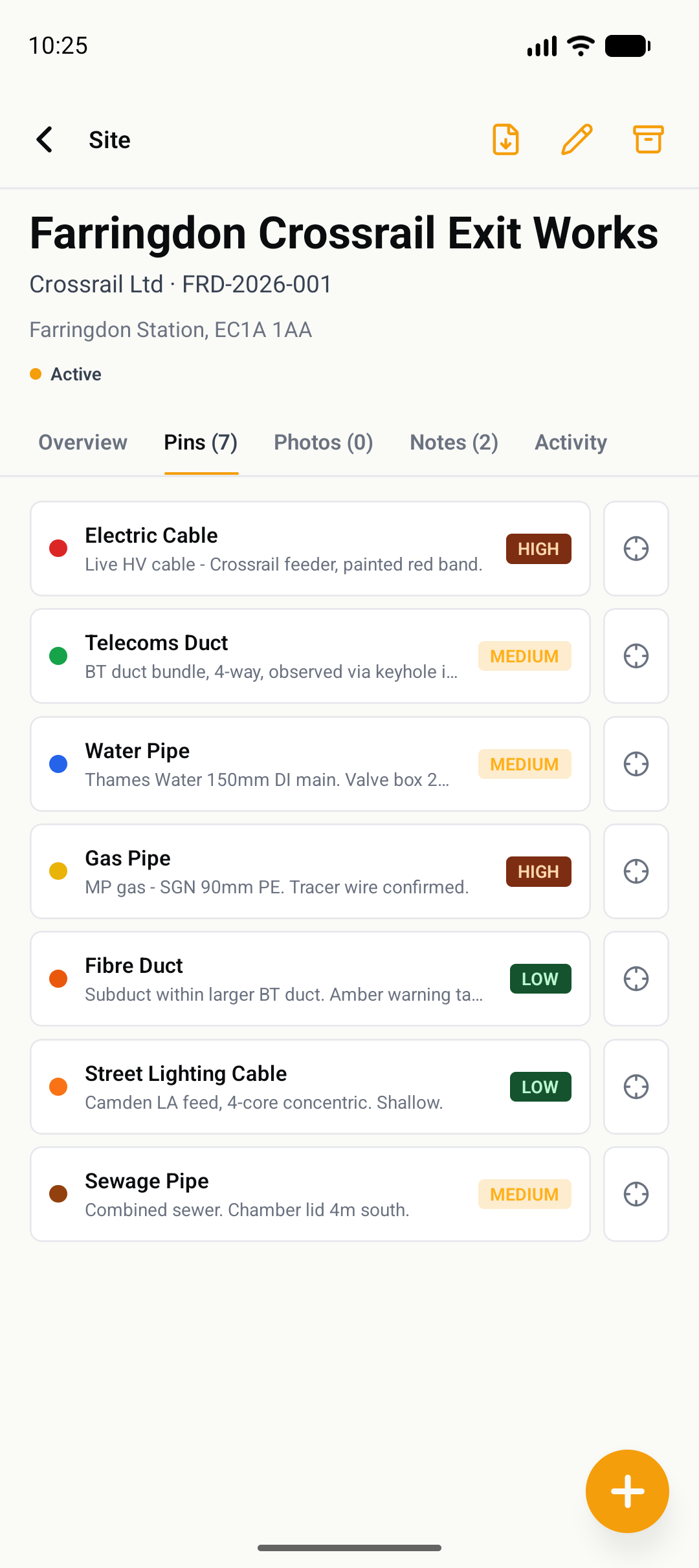
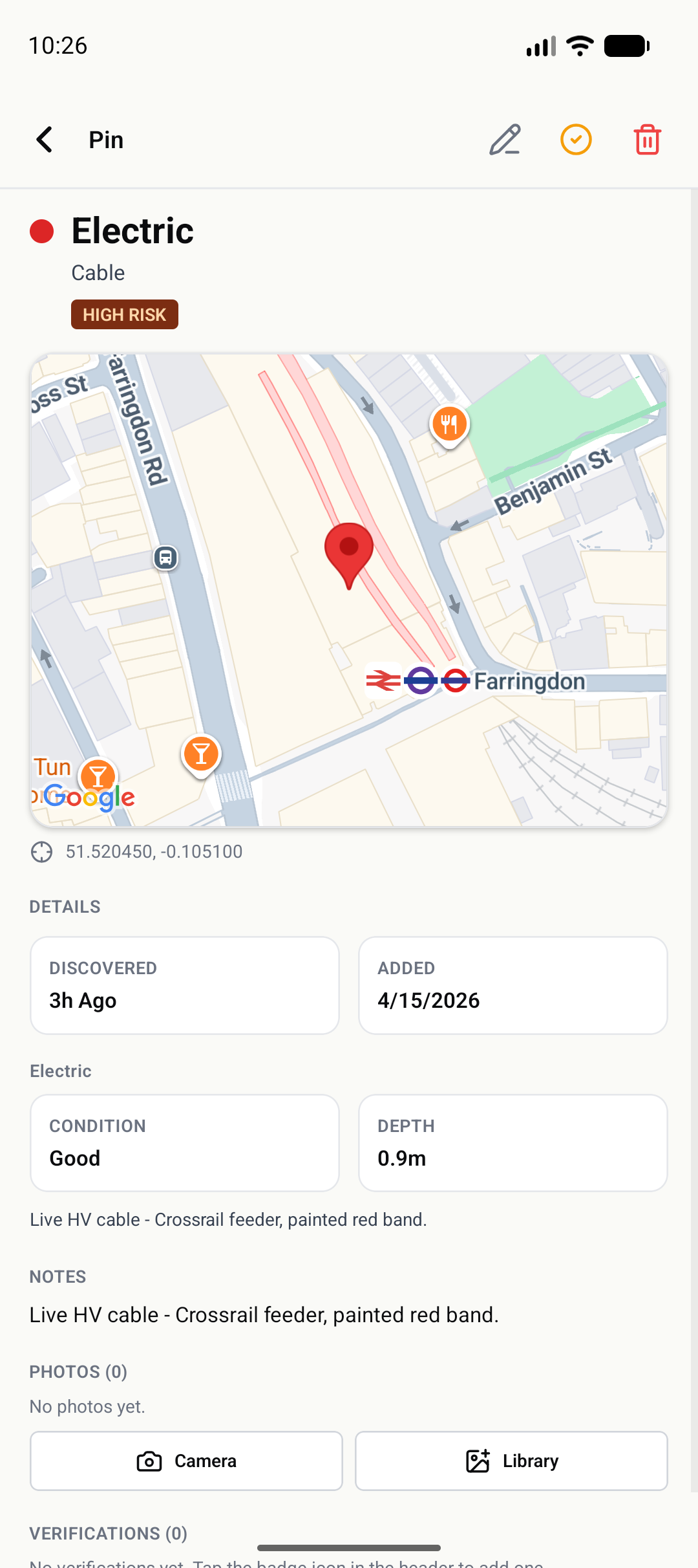
Risk classification
Every pin gets a risk level — Low, Medium, High, or Critical — so the next crew can triage at a glance before they even pick up a spade. Risk badges appear on the map and in the list view.
Offline-first
Works where you work. Pins and photos capture locally on patchy signal and sync the moment 4G returns. No lost data, no “failed to save” on site.
Pin verification
A second crew member can verify a pin independently — confirming the utility is where it was reported. Verified pins display a badge so teams know the intelligence has been ground-truthed twice.
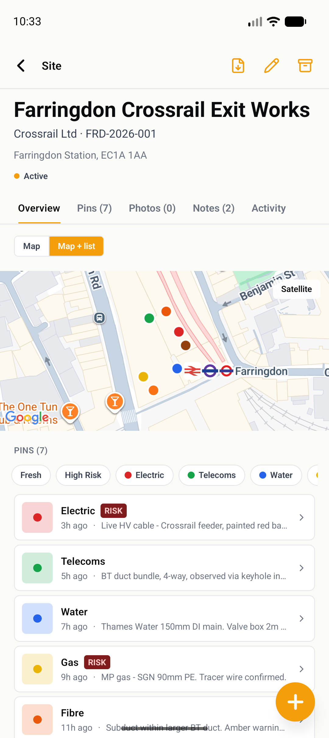
Colour-coded by utility
HSG47-aligned UK industry colours — red electric, blue water, yellow gas — matching CAT scanners and site drawings. No translation needed between the app and the tool in your hand.
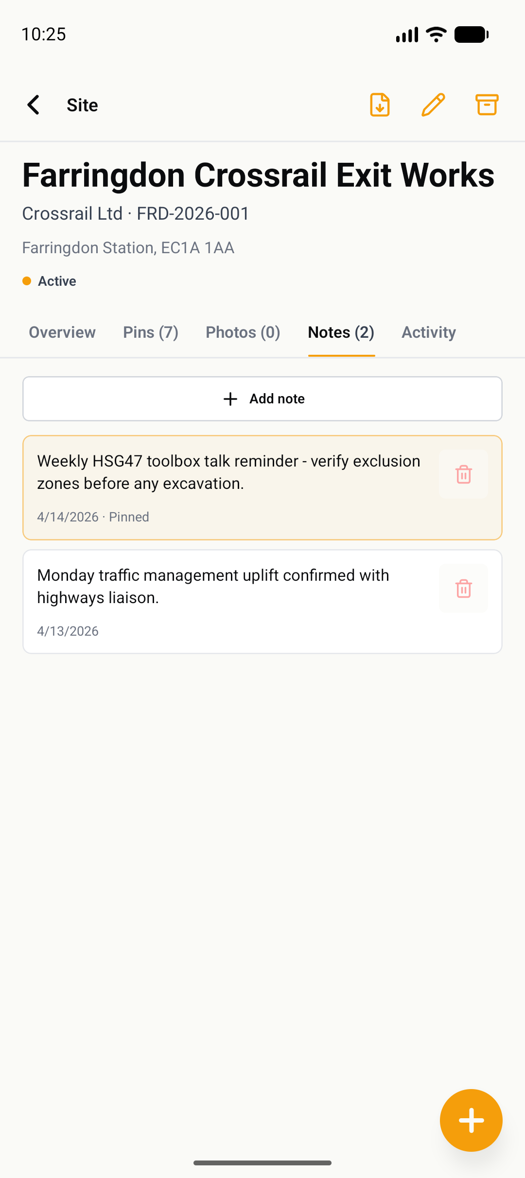
Site notes & activity
Attach notes to any site — pin the HSG47 toolbox talk reminder, log a highways liaison update, flag a permit-to-dig condition. A full activity feed audits every action across your organisation.
Office review, reporting, and team management
The mobile app is where pins get dropped. The web dashboard is where managers review data, export reports, manage team access, and track organisation-wide activity — without needing to be on site.
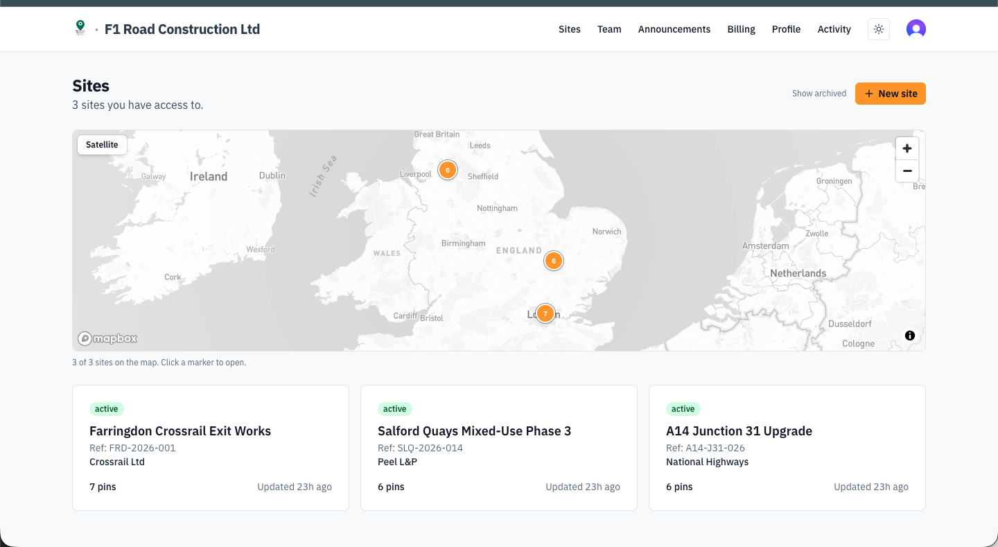
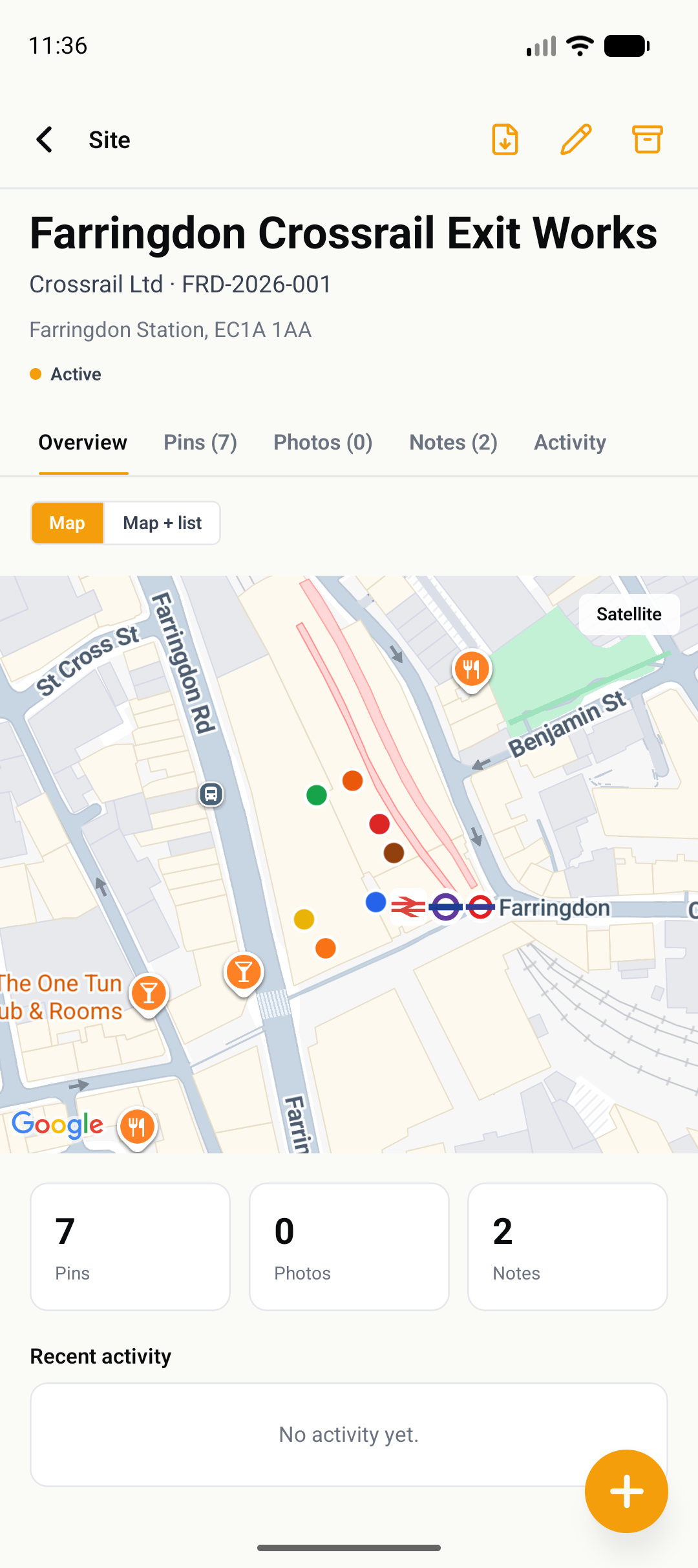
Sites overview — map and list of all active sites in your organisation
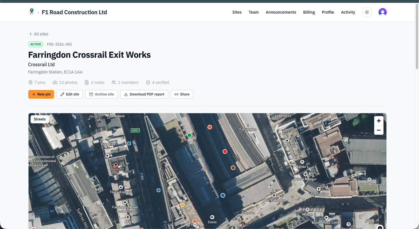
Site detail — satellite map with all pins plotted, quick-access actions for PDF export and sharing
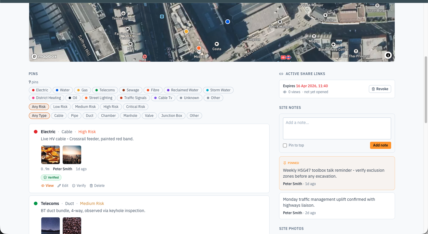
Pins list — filter by utility type, risk level, and verification status; edit or verify any pin from the desk
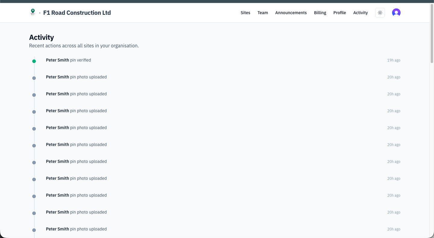
Activity feed — timestamped log of every action across all sites in your organisation
Every strike you avoid pays for the app
Per-user pricing, billed annually. Start free for a single user, scale up as the crew grows.
- Mobile app
- 3 photos per pin
- Solo use
- Unlimited pins & sites
- 10 photos per pin
- Offline mode
- Team sharing & CSV export
- Everything in Team
- PDF reports
- Photo annotation
- Pin verification
- Web dashboard
- what3words integration
- Everything in Pro
- Cross-company data
- Heatmaps & API
- SSO
- Account manager
- Custom integrations
- On-premise options
- SLA
- Data licensing
Ready to stop striking cables?
Sign up on groundpin.co.uk, invite your crew, and start pinning. Free tier is permanent — no card required.
GroundPin is a crowdsourced information tool that complements, but does not replace, statutory utility searches (LSBUD, NUAR), CAT scanning, or safe digging practice under HSG47. Always follow your organisation’s permit-to-dig process.
Need a SaaS product like this?
We design and build web applications from the ground up — auth, billing, mobile apps, and all.
Start a project →